Denali State Park Hiking
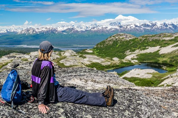
Hiker and view of Mt. McKinley (top right) from ridge near Kesugi Ridge trail, Denali State Park, Alaska. Hikes 64 and 65.
Hiking Overview
Denali State Park offers a wide range of opportunities to explore true wilderness. Its western boundary is shared with Denali National Park and Preserve. The Park is about 133 miles (212 km) north of Anchorage via the George Parks Highway, the major road link between Anchorage and Fairbanks. This highway provides access to the Kesugi Ridge trails described in this book.
Backpack trips in the following table are included in my Denali National Park Alaska Guide to Hiking, Photography and Camping. The start or end of the three Denali State Park backpacking trips can also be dayhikes.
| Kesugi Ridge Hiking Routes* | Starting Point | Ending Point | Trail Distance |
|---|---|---|---|
| Troublesome Creek Trail | Troublesome Creek Trailhead | Byers Lake Campground | 15.2 (24.3 km) |
| Troublesome Creek/Kesugi Ridge Trail | Troublesome Creek Trailhead | Little Coal Creek Trailhead | 36.2 (58 km) |
| Kesugi Ridge Trail | Little Coal Creek Trailhead | Byers Lake Campground | 27.4 (43.8 km) |
| Kesugi Ridge Trail | Little Coal Creek | Trailhead Ermine Hill Trailhead | 17.2 (27.5 km) |
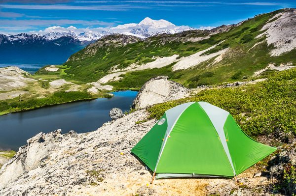
View of Mount McKinley from a campsite on Kesugi Ridge near Ermine Lake in Denali State Park, Alaska.
*Source: Alaska Department of Natural Resources, Division of State Parks and Outdoor Recreation.
Kesugi Ridge, a 35 mile-long north/south alpine ridge, borders the Parks Highway. On a clear day Kesugi Ridge hikers have an unencumbered view of Mt McKinley and the Alaska Range to the west. A hike up (1,500 feet, 456 meters) any of the four (4) hiking trails provides access to a trail along Kesugi Ridge for hikes ranging from 15 to 36 miles (24-58 km). The ridge trail follows a broad alpine tundra plane past ponds, across creeks and around granite boulders.
Camping
Backcountry camping is allowed anywhere along the ridge trail. In order to reduce camping impact there is a designated camping area near popular Skinny Lake. Bring a stove because campfires are not permitted on Kesugi Ridge.
Hiking Conditions
Four trails provide access to Kesugi Ridge and are easy to follow. Little Coal Creek and Ermine Hill trails are the best designed and maintained. Footing and route-finding is occasionally difficult on the Troublesome Creek Trail due to creek bank erosion. The Byers Lake trail up the ridge is steep and is slippery when dry and worse when wet.
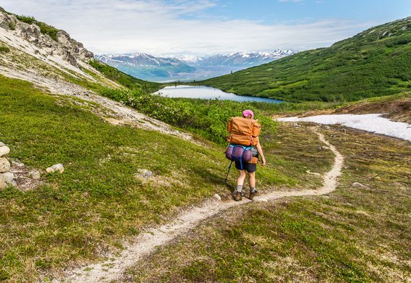
Hiker on the Kesugi Ridge Trail near Ermine Lake, Denali State Park, Alaska. Hikes 64 and 65.
Ridgeline hiking is easy. At the Little Coal Creek end of the ridge, the route crosses short boulder fields that require walking across uneven boulders that may be slippery when wet. A slip into a crack with a full pack may result in injury. Short stretches of the trail descending into the lowest valleys along the ridge route are slippery when dry or wet.
Navigating
Along most of the route, a well-worn trail is clearly visible in the alpine tundra. However the path is not visible in some long rocky areas. Fortunately in rocky areas the route is marked by cairns about 75 feet (14 meters) apart. I was able to follow these cairns in fog so dense that I could not see the next cairn while standing at a cairn. I kept the known cairn in sight until I could spot the next cairn in the fog.
The waterproof Trails Illustrated™ map for Denali National Park also shows the Kesugi Ridge hiking routes. This is a good map for trip planning and identifying distant landmarks. For navigation I prefer the USGS maps referenced for each hike. You will need to draw the route on the USGS maps.
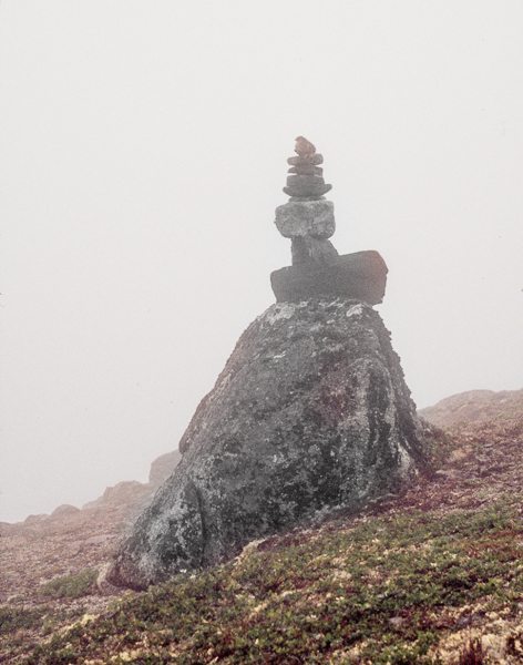
Cairn marking Kesugi Ridge trail, Denali State Park, Alaska.
Bring a compass. I camped about one mile from the trail and awoke the next morning to fog reducing visibility to 100 feet (30 meters). Since I had located my camp on the map the day before, I used my compass to determine and walk the correct direction back to the trail.
Logistics
Alaska/Yukon Trails provides daily bus service between Anchorage and Fairbanks. The bus will drop hikers at Byers Lake and other Denali State Park trailheads. For more information and reservations contact:
Alaska/Yukon Trails
P.O. Box 99708
Fairbanks, Alaska 99711
Phone: 1-888-600-6001 FREE from U.S. and Canada
FAX: 1-907-456-5135
Website: www.alaskashuttle.com
Denali River Guides provides shuttle service between trailheads for independent hikers. Contact:
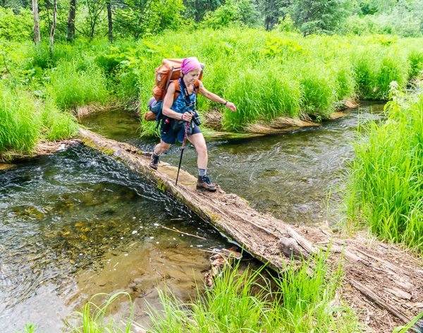
Using a log to cross a stream near the start of Ermine Hill Trail, Denali State Park, Alaska.
Denali River Guides
Located at Byers Lake in Summer
Phone: 907-733-7238
E-mail: explore@denaliriverguides.com
Website: www.denaliriverguides.com
More Denali State Park Information
Check the Denali State Park website for more park information: www.dnr.state.ak.us/parks/. Select “Mat-Su” and then select “Denali State Park”.
All images and content ©Ike Waits